
Historic Maps of Hopkinton
Early plans and surveys of the town, from 1794 to 1889. Use the Maps menu to jump to a year, or try our interactive map of historic sites.
1794
1794 town plan
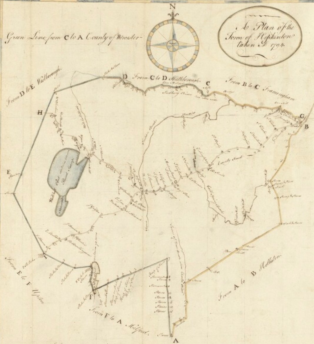
View the 1794 plan at Digital Commonwealth →
A hand-drawn plan of the town showing its boundaries, the County Road, Whitehall Pond and the houses along the roads. The title on the plan reads “A Plan of the Town of Hopkinton taken in 1794.”
1831
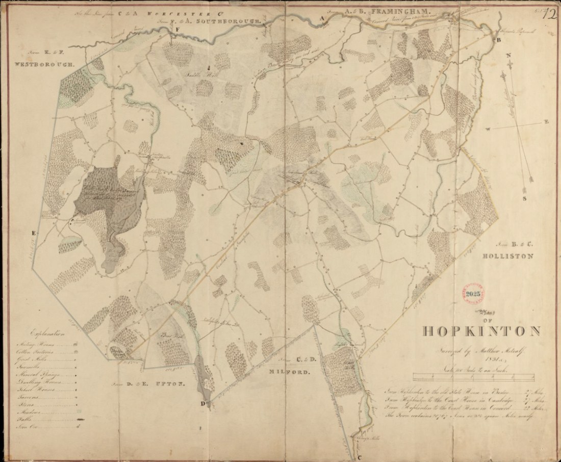
1831 Metcalf survey
Plan of Hopkinton surveyed by Matthew Metcalf, the earliest detailed official survey of the town, walked road by road with a chain and compass. The original is held by the Massachusetts Archives.
1856
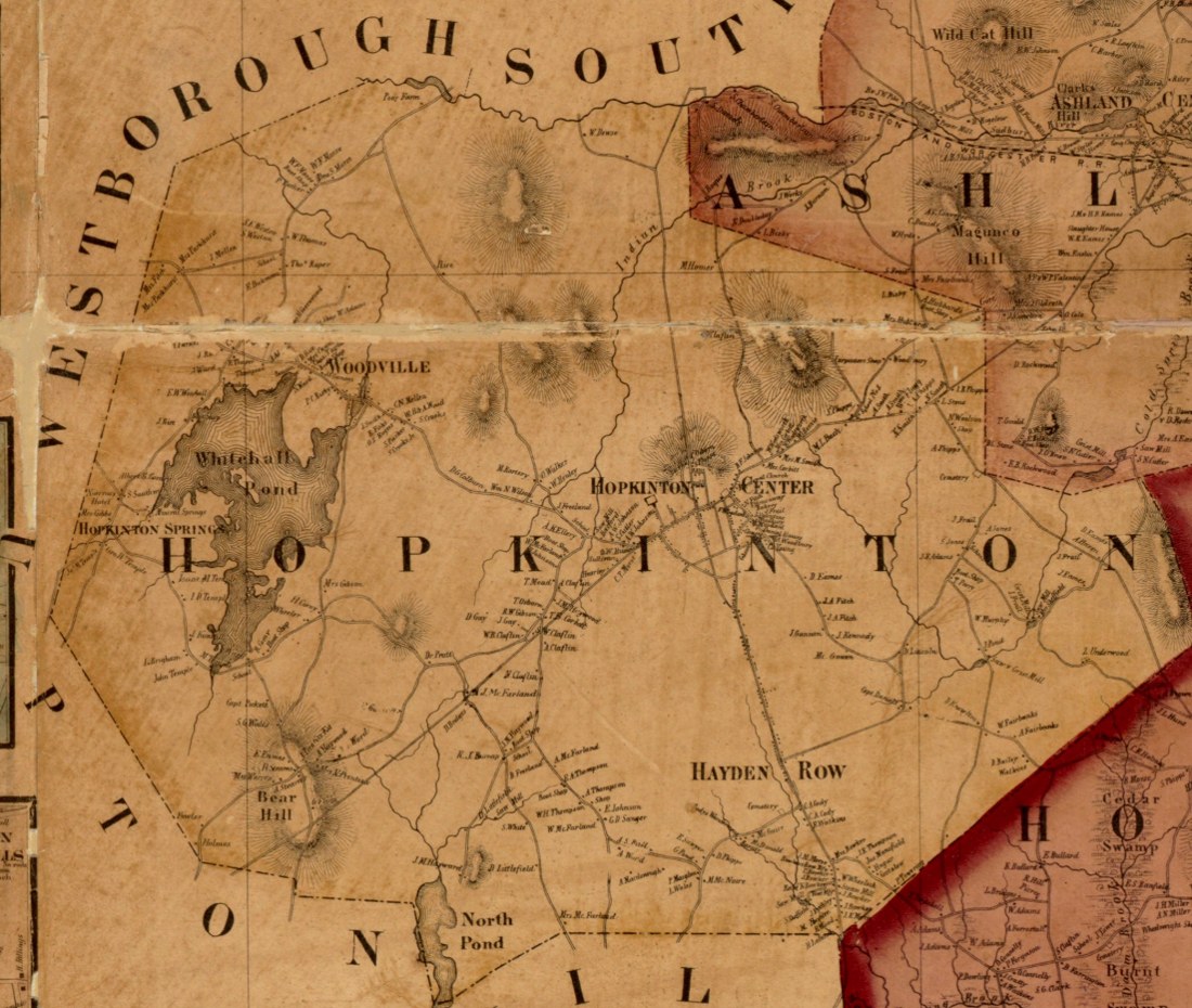
1856 map of Middlesex
The 1856 map of Middlesex County, Massachusetts, which includes Hopkinton, from the Leventhal Map & Education Center collection.
1875
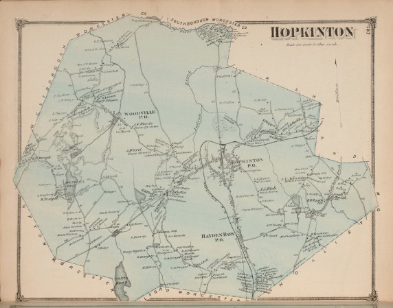
1875 County Atlas of Middlesex
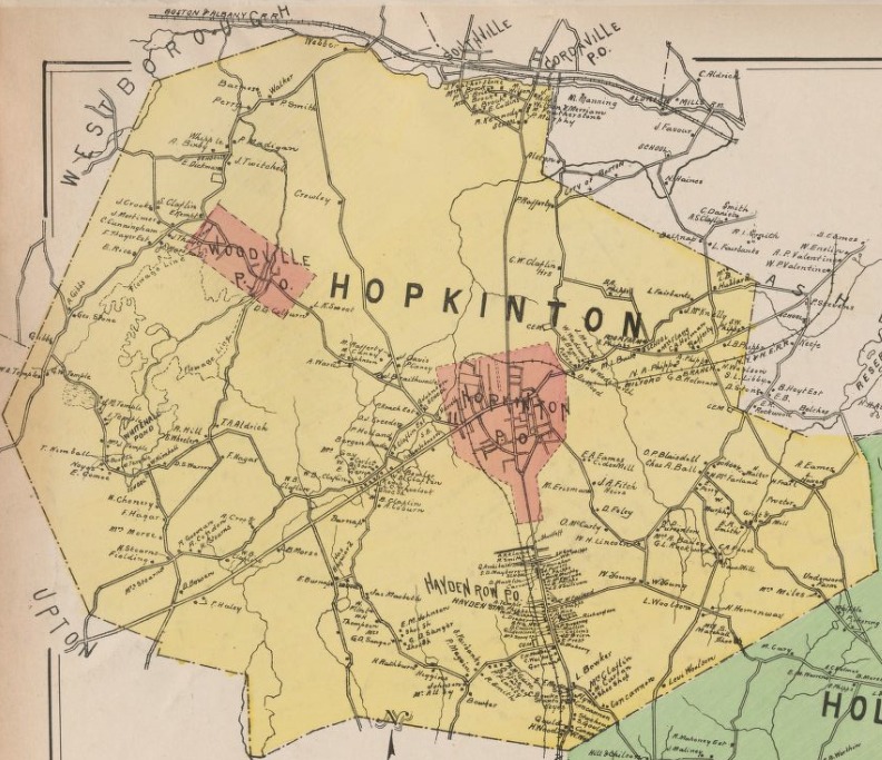
County Atlas of Middlesex, Massachusetts (F.W. Beers & Co., 1875), with detailed town maps showing roads, houses and the names of property owners, including Hopkinton.
1889
1889 Atlas of Middlesex County
Atlas of Middlesex County, Massachusetts (1889), from the Digital Commonwealth collection, with maps of the county’s towns including Hopkinton.
1888–1910
Sanborn Fire Insurance Maps, 1888–1910
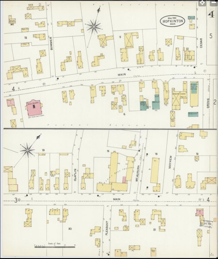
Detailed street-by-street maps of Hopkinton’s village centre, drawn for fire insurance and showing the footprint, size and construction of each building. Five editions are in the public domain at the Library of Congress:
- 1888 edition (February, 2 sheets)
- 1894 edition (March, 3 sheets)
- 1899 edition (February, 5 sheets)
- 1904 edition (March)
- 1910 edition (8 sheets)
On each Library of Congress page, click the sheet thumbnails or “View All” to open the zoomable viewer, which also offers downloads.
USGS
Topographic Maps
Open USGS topoView centered on Hopkinton →
Click anywhere inside Hopkinton on the map to list every historical edition covering that spot in the sidebar. Below are direct links to individual editions from the USGS Historical Topographic Map Collection, for the four quadrangles that meet in Hopkinton.
First-edition survey sheets, 1886–1887 (Atlas of Massachusetts, 1890)
- 1887 Framingham sheet (northeast Hopkinton; surveyed 1887)
- 1886–1887 Marlboro sheet (northwest Hopkinton; surveyed 1886–87)
- 1887 Franklin sheet (southeast Hopkinton; surveyed 1887) · USGS ScienceBase record
- 1886 Blackstone sheet (southwest Hopkinton; surveyed 1886)
Framingham quadrangle
Northeast Hopkinton: downtown, Lake Whitehall and Hopkinton State Park
- 1889 edition (1:62,500, surveyed 1886)
- 1894 edition (1:62,500, surveyed 1886, printed 1938)
- 1943 edition (1:31,680, surveyed 1940)
- 1965 edition (1:24,000)
- 1987 edition (1:25,000)
Marlborough quadrangle
Northwest Hopkinton: Woodville and the north border
- 1969 edition (1:24,000, surveyed 1941, field checked 1969)
- 1977 edition (1:25,000, orthophotoquad)
- 1983 edition (1:25,000)
Franklin quadrangle
Southeast Hopkinton: East Main Street and the Ashland/Holliston border
- 1887 edition (1:62,500, surveyed 1887)
- 1919 edition (1:62,500)
- 1921 edition (1:62,500, field checked 1915, printed 1942)
Blackstone quadrangle
Southwest Hopkinton: Upton/Milford border
- 1900 edition (1:62,500, surveyed 1886, printed 1930)
- 1953 edition (1:31,680, surveyed 1943, revised 1953)
- 1969 edition (1:24,000, field checked 1969)